Catalogue PIGMA
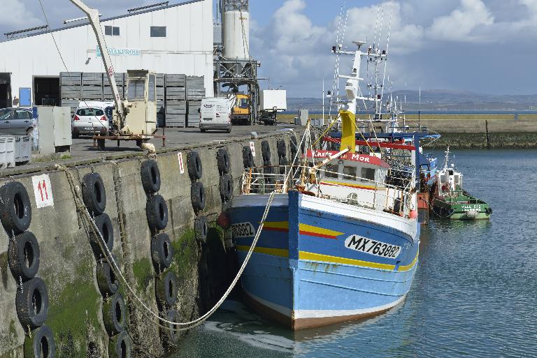
/Human Activities/Coastal monitoring networks
Type of resources
Available actions
Topics
Keywords
Contact for the resource
Provided by
Representation types
Update frequencies
status
Scale
-
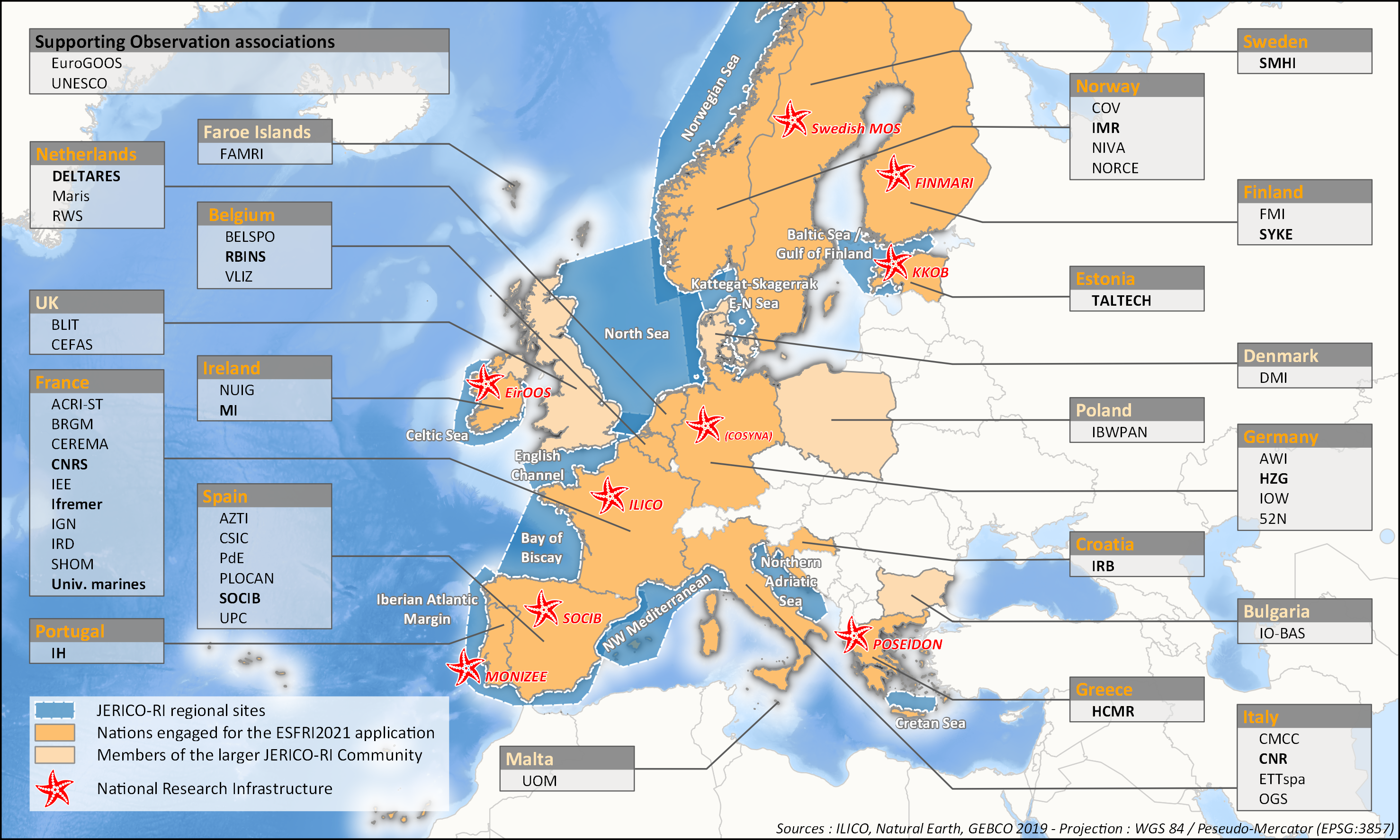
aThis survey action has been undertaken as part of WP6 of the H2020 JERICO-S3 project. Its integration in Sextant is the first step towards a comprehensive and extensive data catalog for the JERICO Research Infrastructure. JERICO-S3, Description of Work - WP6 : Data Management Task 6.2: Data management for coastal platforms (M1-48) (Lead: HCMR) Subtask 6.2.1: Identify and update the overview of JERICO-RI involved platforms and data (SMHI, MARIS, IFREMER) (M1-48) The JERICO dataset catalogue has proven a useful tool for creating an overview of platforms and data relevant for the project this and will be updated. Input from other WP’s will be used to identify the actual JERICO platforms, including the PSS, TNA platforms, and IRS. Partners will collect and describe coastal platforms in the dataset catalogue (technically run in WP7) including pointers to data, which variables (related to EOV’s) published as D6.2. Subtask 6.2.2: Best practice capturing for “mature” platforms with physical and BGC parameters (HCMR, SMHI, CNR, ETT, SOCIB, HZG, RWS) (M6-42). For the following platform types there will be activities supporting data management as defined under T6.4 in close relation to the Virtual Research Environment in WP7: HF radars (CNR), Gliders (SOCIB, ETT), FerryBox (HZG) The work for each platform type will follow basically the same approach and will cooperate with WP4 (PSS) and WP3 (IRS). The experts will identify the existing standards, and possible data management best practices (D6.3). At the end of the project an evaluation will be done of the level of Best Practice adoption at the IRSs and PSSs in the project, as well as the use of the VRE by the partners engaged in WP3 and WP4 (D6.10). This will be done in cooperation with WP3 and WP4, and is an important condition for data to be accessible for use in the Virtual Environment in T7.4.
-
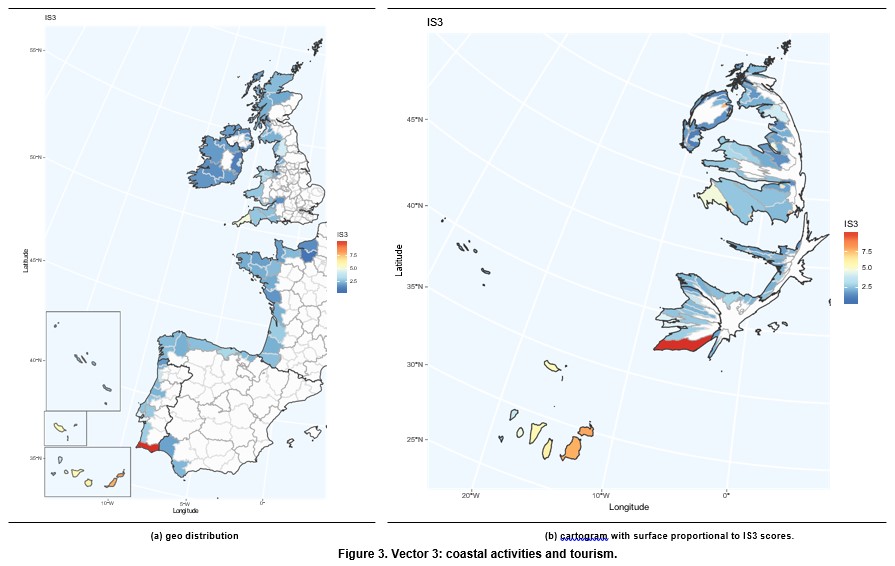
It covers indicators related to demographic pressure, tourism and recreation, economic devel- opment and land use and infrastructure development. This vector captures the impact of human coastal activities on vulnera- bility. In this framework, we are particularly interested in the tourism sector, which is one of the main economic activities in the coast. Tourism is an important economic sector due to its contribution to GDP and employment. According to the World Travel & Tourism Council, Tourims generates 10.4% of all global economic activity. It contributes 319 million jobs, representing one in ten of all jobs globally. It is a sector that has been growing faster than the global economy for the last eight years. Europe plays an important role in this sector with 51% of international tourits arrivals and 39% of international tourist revenues. Taking into account the countries included in the European Atlantic Arc, it is worth pointing out that France and Spain are first and second, respectively, in the world ranking of international tourist arrivals, with United Kingdom in the seventh position. With respect to international tourism revenues, Spain and France are second and third in the world ranking, respectively, while United Kingdom occupies the fifth position. Coastal tourism contributes significantly in theses coun- tries. It represents 75.6% of total tourism in Spain, 28% in Portugal, 23% in France, 10% in Ireland and 6% in the United Kingdom (Foley et al., 2014, p.204).
-
-

-
-
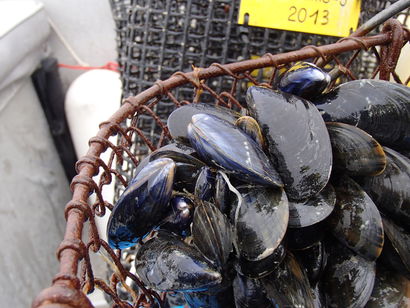
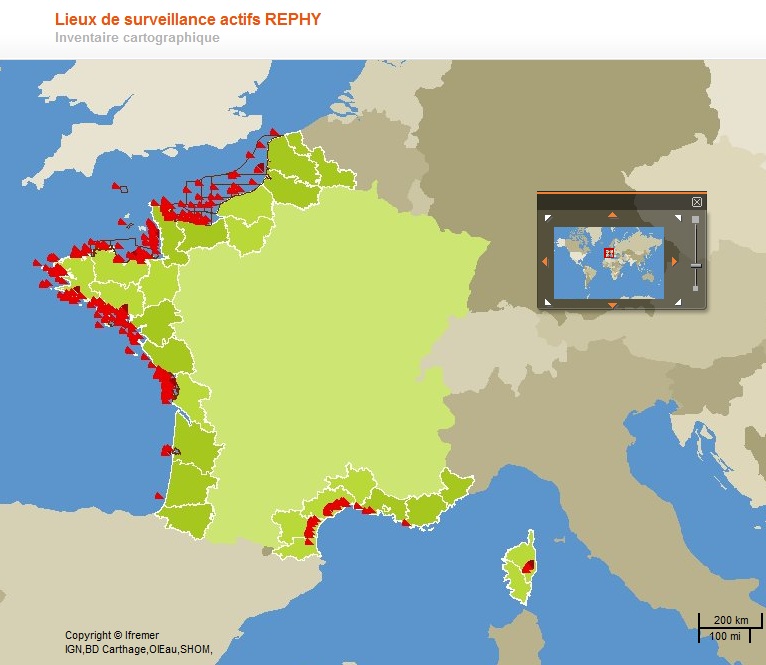
The national observation network for the blue mussel (MYTILOBS), set up in 2012, aims to monitor the growth and mortality of mussels produced for the market. The MYTILOBS is based on the experience of the regional network (REMOULA) which has been monitoring the growth of the blue mussel in the Charentais inlet since 2000. Monitoring mainly takes place the year following the year of capture: it thus integrates the main seasons of the biological life of the mussel, from winter maturation to spring growth, then to summer and fall fattening, the two periods when they are mainly sold. The choice of monitoring sites was decided in consultation between the Regional Environmental Resource Laboratories and the industry. For North Brittany, this is the site of Vivier-sur-Mer in (the sector of) the bay of Mont-Saint-Michel (mussel poles). Each breeding site is monitored every three months. Many parameters are measured including mussel size, weight and mortality. These data are examined taking into account environmental conditions such as temperature, salinity or the abundance and richness of the microalgae on which the shellfish feed. The Mytilobs national network is located in the main mussel-breeding regions of the Atlantic coast: Normandy, North Brittany, South Brittany, Pays de Loire and Poitou-Charentes. The sites of Agon (West Cotentin), Vivier (the bay of Mont Saint-Michel), Pont Mahe (Vilaine bay), Aiguillon (Breton inlet), Yves (Pertuis d’Antioche strait) representing, from north to south, mussel culture using poles. The Filiere site (Pertuis Breton - strait) represents mussels culture using ropes, in full water.
-
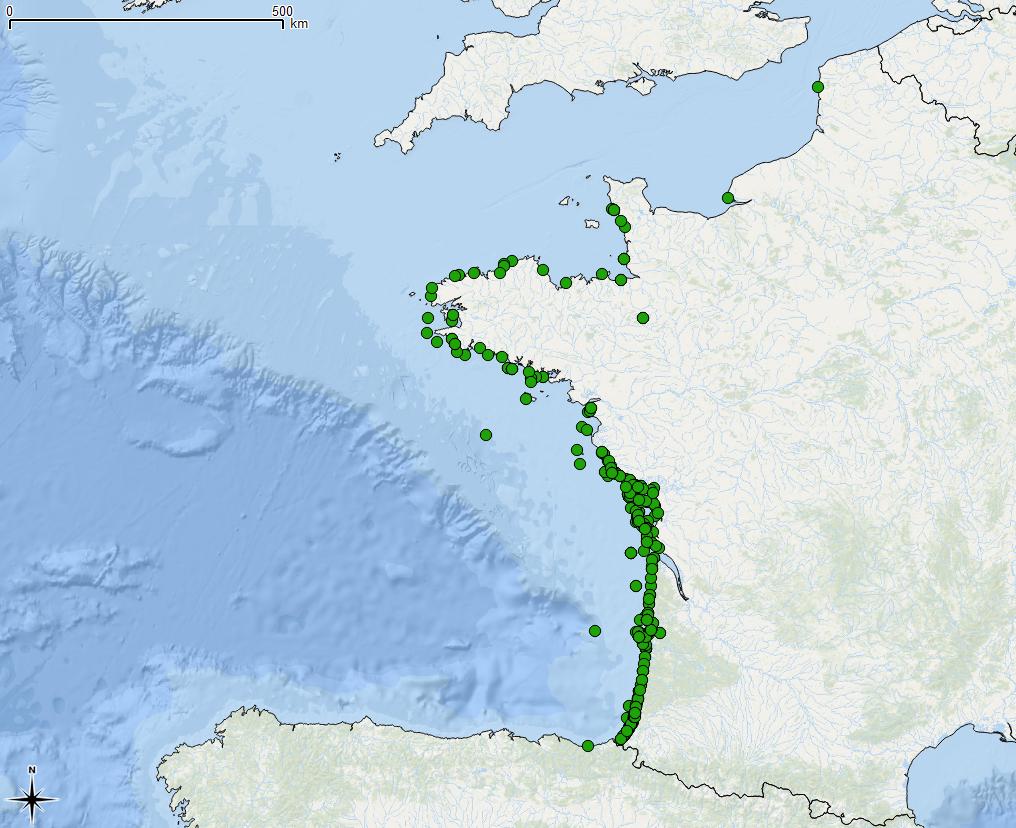
RESOMAR is a national network whose main objective is to bring together studies and monitoring programmes conducted at the network’s stations and observatories (Wimereux, Luc/Mer, Dinard, Roscoff, Brest, Concarneau, Ile d'Yeu, La Rochelle, Arcachon, Anglet, Banyuls, Perpignan, Sète, Marseille, Villefranche / Mer). Based on benthic and plankton community monitoring programmes implemented by the stations, one of RESOMAR’s objectives is to use this biological information in order to answer scientific questions, for example concerning the factors which control the distribution and abundance of organisms on different spatial and temporal scales. This monitoring information, the characteristics of which vary depending on the station (number of sites, frequency, continuous monitoring or not, communities observed, taxonomic resolution, observation methods, etc.) is brought together in two databases (RESOMAR/BENTHOS and RESOMAR/PELAGOS), which are currently being developed. The RESOMAR-PELAGOS database hosts biological data obtained by the pelagic aspects of RESOMAR (around fifteen programmes as of September 2012): http://abims.sb- roscoff.fr/pelagos/ This database in particular brings together observation data (long-term series, inventories, spatial studies, etc.).
-
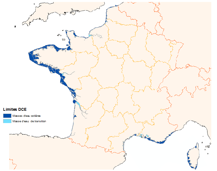
The Water Framework Directive 2000/60/CE is applied to all European Union member states and establishes a new framework for community policy in the water sector with a view to improving management of aquatic environments.
-
-